We all view our surroundings differently

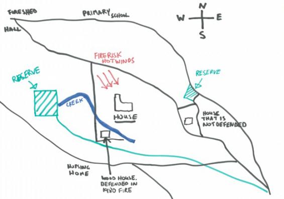
Many rural/urban landscapes, while a fire risk, are beautiful. In many cases this beauty is the reason why people choose to live in these areas, despite the risk. This pilot research project applied the process of ‘place mapping’, a new approach for fire and land management agencies, to gain a better understanding of how communities in rural/urban areas perceive native vegetation in the context of their landscape. Examples include assisting agencies to understand why communities might oppose fuel reduction burning, and why they may not undertake fire mitigation measures that are encouraged by agencies.
Results showed the place mapping process can provide community members with a mechanism through which to communicate their perspectives on the landscape. It further showed place mapping is an additional tool fire and land management agencies can use to better work with communities to take action to reduce bushfire risk.
View Fire Note 121, We all view our surroundings differently, here.
Want to know more about the research after you have read the Fire Note? Researchers have developed a place mapping process and guide for how to engage with your community about fire management. See the guide, along with short videos with the researchers and workshop participants about how the approach works and what to expect at www.bushfirecrc.com/fuels-and-risk. The final report for this project is also available online.
Fire Notes are research summaries in easy to understand language. You can subscribe to receive Fire Notes via email by emailing info@bushfirecrc.com
FOR MORE INFO ...
-
Communications Officer


