Newsletter: March 2009

The Bushfire CRC multi-agency research taskforce is now into the fifth week of gathering as much information as possible about the fires of February 2009 in Victoria.
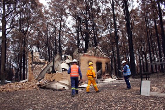
Teams of researchers are currently in the field liaising with agency staff and engaging home owners, survivors and friends and family of deceased as well as surveying the physical form of the impacted areas.
A range of fire and land management agencies, research partners and private companies have provided support and committed resources to assist in the data collation, which has three research streams:
- Fire Behaviour: The focus is on strategic fire behaviour – how the fires moved across different landscapes, different vegetation and under variable weather conditions.
- Human Behaviour and Community Safety Issues: This is focusing on behaviour and decision making by residents, community responses to bushfire warning messages and the implication of these events on policy.
- Building (infrastructure) and Planning issues: The researchers are looking at patterns of loss and patterns of survival of buildings and structures, the notion of defendable space and planning and building controls and their impact on patterns of building losses.
DEPLOYMENT TIMELINE / CREW ROTATION
Research teams have been deployed into fire impacted areas from 12 February 2009. The crews have been rotated every five days with fresh teams. All rotations are coordinated through the Bushfire CRC office, with support from AFAC and NAFC staff, to ensure a coordinated and managed process and a comprehensive briefing and debriefing of teams.
It is planned that the field data collation will be completed by the end of this week, apart from smaller scale visits to select sites.
HEALTH, SAFETY AND RISKS
The stress on crews, in particular the social researchers, is being closely monitored with counselling and treatment available as required. All teams are provided with a pre deployment briefing that includes messages on indentifying and handling the situation in the field - including the psychological impact of this type of work.
Days of Total Fire Ban are considered as high risk due to strong winds and the elevated risk of falling trees and raised dust. Crews did not operate on these days and other days of high winds.
DEPLOYMENT LOCATIONS
Research Teams have been deployed to the localities of St Andrews, Kinglake, Kinglake West, Clonbinane, Bendigo Murrindindi, Strathewen, Churchill, Jeeralang, Callignee, Wandong, Steels Creek, Flowerdale and Koornalla. This week the teams have gained access to Marysville.
COMPLETED PROPERTY ASSESSMENTS
As of the start of this week, 957 properties have been assessed at an average of more than 30 a day. The following table breaks down the condition of the properties inspected.
Untouched
236
Damaged
151
Destroyed
475
Further processing required
95
TOTAL
957
Given that it is not possible to assess every building within the fire perimeter data is being collected from a sample of sites across the major fires and several of the minor fires.
In addition up to 12 sites will be selected for a more detailed integrated analysis of each of the three themes to assess what can be attributed to either fire or human behaviour or building standards.
RESEARCH STREAMS PROGRESS
Fire behaviour
- Field work has concentrated on establishing the path of spread, in particular the location of the fire front at the time of the wind change, using physical indicators that will degrade over time.
- Utilisation of the agencies summaries of the incident logs, media footage and witness statements will be necessary to identify the time the fire reached various locations within the major runs.
- The Bureau of Meteorology is providing an analysis of weather conditions across the five major fires.
Building infrastructure and planning
These teams are looking at patterns of house loss and survival, recording their structure, house and property design and layout, and the proximity to other structures.
- They are using technology including GPS enabled Toughbooks, digital voice recorders, and cameras that have geo-referencing capability and cadastre technology that identifies relevant land parcels.
- Planning regimes are being assisted by high resolution satellite imagery and CSIRO Remote Sensing Data.
Human behaviour and social issues
- These teams are conducting qualitative interviews (around 150 so far) to extrapolate quantitative evidence.
- It has been noted that the impact on researchers may increase as they turn their research focus on areas of greatest fire impact and life/property loss.
FOR MORE INFO ...
-
Communications Manager


