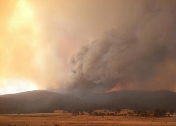
Tasmanian bushfires fire behaviour 2013

This report provides information on the areas burnt and fire behaviour of some of the fires that occurred during the 2012–13 Tasmanian fire season. The fires covered are: Forcett–Dunalley, Repulse, Bicheno, Giblin River, Montumana, Molesworth and Gretna. In total, the fires covered in this report burnt about 90 175 ha (out of the nearly 120 000 ha that was burnt during the 2012–13 Tasmanian fire season).
The period January to March 2013 featured well above normal Fire Danger and atmospheric instability. This resulted in the 2012–13 Tasmanian fire season being the worst since February 1967, with about 128 wildfires being recorded that burnt about 119 267 ha (about double the yearly average for the preceding 10 years). Over the summer, more than 200 houses were destroyed.
Detailed weather, fuel, site and fire behaviour data has been collated for a total of 12 fire runs. Five of these fire runs were burning with extreme levels of fire behaviour, four were burning with very high levels of fire behaviour, two were burning with high levels of fire behaviour and one had moderate levels of fire behaviour.
The observed rates of fire spread for the fires were compared against predictions made by the McArthur Forest Fire Danger meter, Project Vesta, Phoenix RapidFire, Buttongrass Moorland and CSIRO Grassland fire models. The McArthur model provided very poor predictions, under-predicting fire spread rate by an average of 73%. The Project Vesta, Phoenix RapidFire and Buttongrass Moorland models provided good predictions of head fire spread rate, with the average predicted versus observed head fire spread rates being about -4%, 14% and 13% respectively. The CSIRO grassland fire model over-predicted the head fire spread rate by nearly 75%. Phoenix RapidFire also provided predictions of flank fire spread rate, with the predicted versus observed flank fire spread rates being about 43%. None of the McArthur Forest Fire Danger meter, Project Vesta, CSIRO Grassland or Buttongrass Moorland fire models predict flank fire spread rate. In dry eucalypt forest, the Project Vesta provided the best predictions of head fire spread rate.
The main driver of the extreme levels of fire behaviour observed during these fires was a combination of surface weather conditions and atmospheric instability. During the time periods when the fires were making their major runs, both of these factors were at very high levels. This means that in order to predict the likely fire behaviour during these conditions, measures of both of these factors are required. This can be done using a combination of the Fire Danger Rating to give an estimate of the conditions prevailing at the ground surface and the C-Haines Index for a measure of atmospheric instability.
During each of the Forcett–Dunalley, Repulse, Bicheno and Giblin River fires, high-intensity fires burnt into recently burnt areas. In each of these situations, the head fire’s spread rate, intensity and spotting were stopped or greatly reduced, indicating the value of low-fuel-hazard areas for reducing the level of fire risk.
This report also identifies the importance of early response with adequate resources, effective mop-up and patrol, and the importance of identifying the conditions where effective suppression is not feasible so that fire crews can pull back and all resources can be applied to protecting life and property. For example, when the fire danger rating is high or above and the C-Haines Index is above 8 (and especially when it is above 10), fire suppression operations are often ineffective and fire-management agencies need to concentrate on protecting life and property.
Related News
(sorry, no news items for this event)


